California stretches over 800 miles from north to south, packed with diverse landscapes that range from rugged coastlines to towering mountains and vast deserts. Planning a road trip here can feel overwhelming with so many options, but the key is understanding how to connect the best stops into a route that works for your time and interests.
A great California road trip combines iconic coastal drives, major cities, national parks, and hidden gems into one loop that you can start and finish anywhere.
The state offers something for every type of traveler. You can spend mornings hiking through giant sequoia trees and afternoons watching waves crash against sea cliffs. Cities like San Francisco, Los Angeles, and San Diego provide urban culture and food scenes, while small coastal towns and desert landscapes offer quiet escapes.
This guide breaks down everything you need to know to plan your trip. You’ll learn which routes to take, how long to spend in each area, and what to see along the way. Whether you have one week or one month, you can build an itinerary that fits your style.
Key Takeaways
- California road trips work best as loops that connect coastal highways, national parks, and major cities
- You can start your route anywhere and adjust the itinerary based on your available time and interests
- Planning around seasonal weather and road conditions helps you avoid closures in mountain areas
How to Plan Your Ultimate California Road Trip

Planning a California road trip requires careful thought about timing, budget, and logistics. The state spans over 800 miles from north to south, so you need to consider seasonal weather patterns, set realistic spending expectations, and use the right tools to navigate this massive region.
Choosing the Best Time to Visit
The best time to visit California depends on which regions you want to explore. Spring (March to May) and fall (September to November) offer the most balanced weather across the state. You’ll find mild temperatures, fewer crowds, and lower accommodation prices compared to peak summer months.
Summer brings perfect beach weather but also higher costs and packed attractions. Coastal areas stay comfortable due to ocean breezes, but inland valleys and deserts can reach over 100°F. Winter is ideal for budget travelers and those visiting Southern California, though snow closes some mountain passes in the Sierra Nevada.
Northern California sees more rain from November through March. Southern California stays dry most of the year. If your California road trip includes national parks like Yosemite, check seasonal road closures before booking. Tioga Pass typically closes from November to May.
Budgeting and Costs Overview
A realistic daily budget for California road trips ranges from $75 to $150 per person. This covers gas, car rental, lodging, food, and attraction fees. Gas prices in California rank among the highest in the nation, often $1-2 more per gallon than other states.
Your biggest expense will be the rental car. Book at least two months ahead to secure better rates. Consider renting outside major airports to save 10-20% on fees.
Daily Cost Breakdown:
- Campground: $10-$20
- Budget hotel: $80-$120
- Restaurant meal: $15-$25
- Gas (per day): $30-$50
- National park entry: $30-$35 per vehicle
Buy an America the Beautiful Pass for $80 if you plan to visit multiple national parks. This single pass covers entry to all federal recreation sites for one year. Camping saves significant money compared to hotels. Many state and national parks offer campsites for under $25 per night.
Essential Travel Tips and Tools
Download offline maps in Google Maps before you start driving. Cell service disappears in many rural areas, mountain passes, and desert regions. Save your entire California travel route so you can navigate without data.
Book accommodations in advance during summer and holiday weekends. Popular spots like Big Sur, Yosemite, and Lake Tahoe fill up months ahead. Your California travel guide should include backup lodging options in case your first choice is full.
Pack layers regardless of season. Temperatures can swing 30-40 degrees between coastal and inland areas on the same day. Bring a reusable water bottle since California has strict environmental regulations and bottled water costs add up quickly.
Check road conditions through Caltrans before driving mountain routes. Winter storms can close highways with little warning. Keep your gas tank above half full in remote areas where stations are 50+ miles apart.
Crafting the Perfect California Road Trip Itinerary
The right itinerary length and route type can make or break your California road trip. Your choice depends on how much time you have and whether you want to see specific regions or experience the entire state.
Itinerary Lengths: 7, 10, or 14 Days
A 7-day California road trip works best when you focus on one region. You can cover San Francisco to Big Sur or explore Southern California from Los Angeles to San Diego. This timeline gives you enough time to see major highlights without rushing through each stop.
A 10-day itinerary lets you combine coastal drives with inland attractions. You could drive the Pacific Coast Highway from San Francisco to San Diego while adding stops at national parks like Joshua Tree or Yosemite. Plan for 4 to 5 hours of driving per day with this timeline.
A 14-day road trip opens up the full California experience. You can visit both the coast and desert, explore wine country, and spend quality time in major cities. This length allows you to tackle the complete 2,455-mile loop that includes San Francisco, Yosemite, Death Valley, Palm Springs, San Diego, and the Pacific Coast Highway back north.
Loop Versus One-Way Routes
Loop routes start and end in the same city, which saves you money on one-way car rental fees. A popular loop begins in San Francisco, heads south along the coast to San Diego, then returns north through the desert and mountains. This route covers diverse landscapes without backtracking.
One-way routes work well when you want to maximize coastal time or focus on specific areas. The classic San Francisco to San Diego drive along Highway 1 takes about 10 hours of pure driving time but deserves at least 7 days with stops. You’ll pay extra for one-way rental fees, typically $100 to $200.
Your starting point matters. San Francisco offers better access to Northern California’s redwoods and wine country. Los Angeles puts you closer to Joshua Tree and Palm Springs.
Shortcuts and Detours
Highway 101 serves as the fast alternative to Highway 1 when you need to save time. You can cut 2 to 3 hours off your coastal drive between San Francisco and Los Angeles by taking 101 instead. This route still offers ocean views but skips dramatic sections like Big Sur.
Worth-it detours include the 17-Mile Drive in Monterey ($10 entry), Lake Tahoe from Sacramento (3 hours each way), and Death Valley from Las Vegas (2 hours each way). Each adds significant travel time but delivers unique California experiences.
Skip destinations that don’t match your interests. Wine tasting in Paso Robles or Sonoma can be skipped if you don’t drink. Theme parks like Disneyland require full days, so only include them if they’re priorities. You can drive through small coastal towns without overnight stays to maintain momentum while still seeing the scenery.
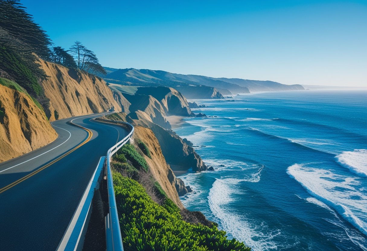
Iconic Coastal Journeys: Pacific Coast Highway & Beyond
California’s coastal highways deliver stunning ocean views, dramatic cliffs, and access to seaside towns. Highway 1 offers the most famous route, while Highway 101 provides a faster alternative with its own scenic stops.
Driving the Pacific Coast Highway (Highway 1)
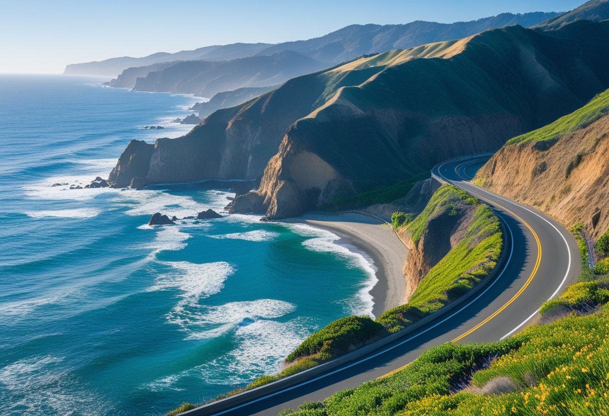
Highway 1 runs along California’s coast and gives you some of the most beautiful driving in the country. The route stretches from Southern California to Northern California, with the Big Sur section between Carmel and San Simeon earning its reputation as the most scenic.
You’ll find iconic landmarks like Bixby Creek Bridge, where the road curves over a deep canyon with ocean views. Stop at Garrapata Beach for a quiet coastal walk or photo opportunity. The drive takes 10-12 hours nonstop, but you should plan 3-7 days to enjoy it properly.
Drive southbound when possible. This puts you on the ocean side, making it easier to pull into viewpoints safely. Watch for morning fog along the coast, especially in summer. Gas stations are rare and expensive through Big Sur, so fill up early.
Plan overnight stops in towns like Carmel-by-the-Sea, Cambria, or Santa Barbara. Spring through early fall offers the best weather, with April to October providing clear skies and warm temperatures.
Highway 101 and Alternative Coastal Routes
Highway 101 runs parallel to Highway 1 through much of California and moves faster when you need to cover ground quickly. The route passes through Santa Barbara, San Luis Obispo, and other inland cities while still offering coastal access.
You can combine both highways on your California coast road trip. Take Highway 1 through Big Sur for views, then switch to Highway 101 to save time heading north or south. Highway 101 also serves as your backup when Highway 1 closes due to weather or landslides.
The route offers its own stops worth visiting. You’ll pass through wine country near Paso Robles and historic missions in San Luis Obispo. Traffic moves smoother on Highway 101, and you’ll find more gas stations, restaurants, and hotels along the way.
California’s Most Unforgettable Cities and Urban Stops
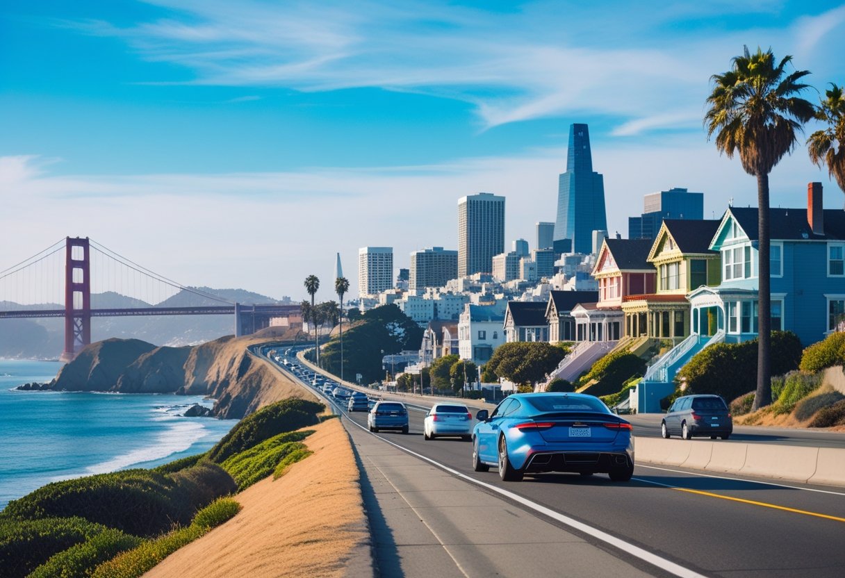
California’s major cities offer distinct experiences that make them essential stops on any road trip. San Francisco charms visitors with its iconic bridges and waterfront attractions, Los Angeles blends entertainment history with coastal relaxation, and San Diego delivers a perfect mix of culture and seaside beauty.
San Francisco: Golden Gate to Fisherman’s Wharf
You’ll find San Francisco easy to explore without a car during your stay. The city’s public transit connects most major attractions.
The Golden Gate Bridge stands as the city’s most recognizable landmark. You can walk or bike across the 1.7-mile span for views of the bay and city skyline. Golden Gate Park stretches over 1,000 acres and houses the California Academy of Sciences, Japanese Tea Garden, and several museums.
Fisherman’s Wharf offers seafood restaurants, street performers, and views of Alcatraz Island. You can catch a ferry to the former prison island or watch sea lions at Pier 39. The waterfront area includes the Maritime National Historical Park and the San Francisco Bay Aquarium.
The city’s neighborhoods each have their own character. Chinatown is the oldest in North America, while Haight-Ashbury showcases Victorian architecture and counterculture history. Cable cars run between these districts and provide a classic San Francisco experience.
Los Angeles: Hollywood and Beach Vibes
Los Angeles spreads across 500 square miles, so you’ll need to plan your stops carefully. The Hollywood Sign sits in the hills above the city, visible from many viewing points including the Griffith Observatory. The observatory offers free admission and nighttime telescope viewing.
The Hollywood Walk of Fame runs along Hollywood Boulevard with over 2,700 stars embedded in the sidewalk. You can visit the TCL Chinese Theatre nearby to see celebrity handprints and footprints in the forecourt.
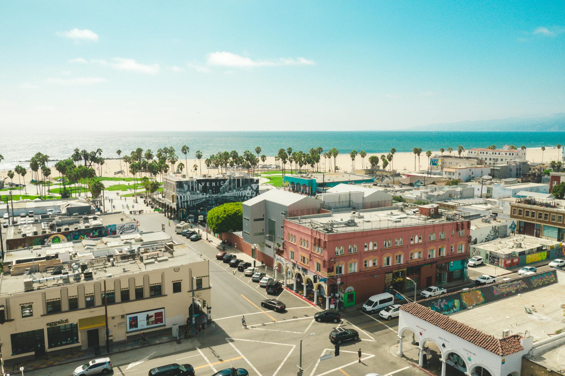
Santa Monica Pier marks the end of Route 66 and features an amusement park, aquarium, and restaurants. The beach extends for 3.5 miles with a paved path for walking and biking. Venice Beach sits just south and is known for its boardwalk, outdoor gym, skate park, and street performers.
You’ll find world-class museums at the Getty Center and LACMA. The city’s diverse neighborhoods serve food from dozens of cultures.
San Diego: Arts, Food, and La Jolla
San Diego sits 22 miles south of smaller beach towns and offers warm weather year-round. Balboa Park covers 1,200 acres and contains 17 museums, gardens, and the Tony Award-winning Old Globe Theatre. The San Diego Zoo within the park houses over 3,500 animals across 100 acres.
La Jolla features seven distinct beaches and sea caves you can explore by kayak. The Children’s Pool beach hosts a colony of harbor seals and sea lions. You’ll find upscale shops and restaurants along Prospect Street.
The Gaslamp Quarter downtown spans 16 blocks of Victorian buildings converted into restaurants, bars, and clubs. The neighborhood hosts farmers markets on Thursdays and offers food tours that showcase the city’s culinary scene. The waterfront Embarcadero area includes the USS Midway Museum and Seaport Village shopping complex.
Central Coast Treasures and Wine Country Escapes
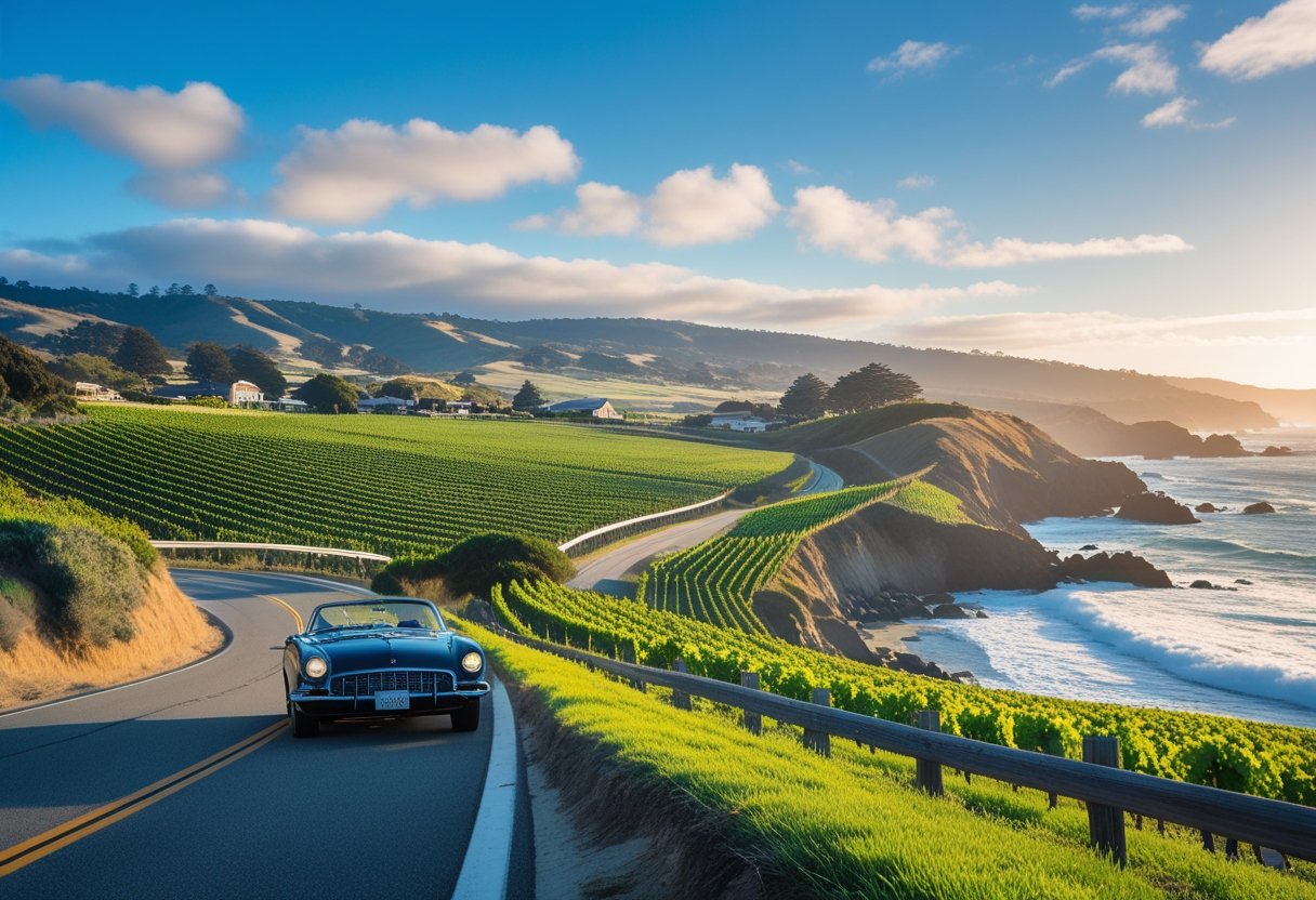
The Central Coast connects stunning beach towns with world-class wine regions between San Luis Obispo and Santa Barbara. You’ll find dramatic coastlines, Danish-inspired villages, and hundreds of wineries spread across rolling hills and coastal valleys.
Santa Barbara and Coastal Charms
Santa Barbara offers Spanish colonial architecture, palm-lined beaches, and a downtown area perfect for walking. You can explore the Funk Zone, where former warehouses now house urban tasting rooms, art galleries, and restaurants. The neighborhood sits between State Street and the waterfront.
The nearby town of Solvang provides a different experience with its Danish-style buildings, bakeries, and windmills. You’ll find wine tasting rooms throughout the village. Los Olivos, just minutes away, has become known for its Grenache wines and small tasting rooms along the main street.
The Santa Ynez Valley surrounding these towns produces over 42 grape varieties. Coastal fog flows through the valley’s east-west orientation, creating ideal growing conditions for Pinot Noir. You can visit tasting rooms in small towns or drive directly to vineyard estates.
Wine Tasting in Paso Robles and Napa Valley
Paso Robles has more than 200 wineries across 26,000 acres of vineyards. The region specializes in Rhône-style wines, including Syrah, Grenache, and Viognier. You’ll find tasting rooms in the downtown area and wineries scattered across rural hillsides.
The Edna Valley near San Luis Obispo offers sustainable wineries like Tolosa with views of wind-swept valleys. About 50 wineries participate in the SLO Sustainable Wine Trail along Highway 101.
Napa Valley sits north of San Francisco, requiring a detour from the coastal route. The valley contains hundreds of wineries ranging from large estates to small family operations. Oxbow Public Market in downtown Napa provides local food vendors and wine bars. Sonoma Valley offers a more relaxed alternative with similar quality wines.
Sights from Pismo Beach to Carmel-by-the-Sea
Pismo Beach gives you access to sandy beaches, the historic pier, and nearby dunes. The Madonna Inn in San Luis Obispo features 110 uniquely decorated rooms and has been a roadside attraction since 1958. You can stop for a meal or tour the property even if you’re not staying overnight.
Highway 1 continues north through dramatic coastal scenery. Morro Bay features a 576-foot volcanic rock rising from the water. Cambria offers art galleries and wine tasting rooms in a coastal village setting.
Carmel-by-the-Sea provides upscale shopping, art galleries, and a white sand beach. The town has no street addresses or chain restaurants. You’ll find cypress trees, fairy-tale cottages, and easy access to nearby attractions like Point Lobos State Natural Reserve.
Big Sur and the Monterey Peninsula: Scenic Wonders
The central California coast delivers some of the state’s most dramatic scenery, from the famous curves of 17-Mile Drive to the rugged cliffs of Big Sur. You’ll find purple sand beaches, towering redwoods, and coastal views that stretch for miles.
17-Mile Drive and Monterey Bay
The 17-Mile Drive winds through Pebble Beach between Carmel and Monterey, offering access to pristine coastline for a toll of about $11 per vehicle. You’ll pass iconic spots like the Lone Cypress and several lookout points where harbor seals and sea lions gather on the rocks below.
Monterey itself centers around the waterfront. The Monterey Bay Aquarium ranks among the world’s best, with exhibits featuring sea otters, jellyfish, and a massive kelp forest tank. Plan to spend at least three hours here.
Fisherman’s Wharf and Cannery Row provide dining options and shopping. Monterey Bay is known for whale watching, with humpback and blue whales visible from April through November. Gray whales migrate past from December through April.
The bay area also offers kayaking opportunities where you can paddle among kelp forests and spot sea otters up close.
Big Sur Highlights: McWay Falls to Pfeiffer Beach
Highway 1 through Big Sur covers 91 miles of coastal road. McWay Falls at Julia Pfeiffer Burns State Park drops 80 feet onto the beach below and is accessible via a short half-mile trail. The waterfall is visible year-round, though California’s dry summers may reduce its flow.
Pfeiffer Beach requires a two-mile drive down a narrow, unmarked road off Highway 1. Look for a small sign that says “Pfeiffer Beach” on the west side of the highway. The beach features purple sand from manganese garnet deposits and rock formations with natural arches.
Garrapata Beach offers easier access with multiple pullouts along Highway 1. The coastline here includes dramatic cliffs and a sandy beach reached by a short trail.
Point Lobos State Natural Reserve sits at Big Sur’s northern edge. Its trails lead through cypress groves to coves where you can watch sea lions and harbor seals.
Late spring brings the best weather and green hillsides covered in wildflowers.
Seaside Stops: Santa Cruz and Surrounds
Santa Cruz sits about 77 miles north of Monterey. The Santa Cruz Beach Boardwalk opened in 1907 and remains California’s oldest surviving amusement park. The Giant Dipper wooden roller coaster dates to 1924 and still operates during summer months and select weekends.
The town has several surf breaks. Steamer Lane near the lighthouse draws experienced surfers, while Cowell Beach works better for beginners. You can rent boards and wetsuits from several shops along the waterfront.
Henry Cowell Redwoods State Park is located six miles north of Santa Cruz. The Redwood Grove Trail is an easy 0.8-mile loop through old-growth trees, some reaching over 250 feet tall. The park also has more challenging trails into the backcountry.
Natural Bridges State Beach west of downtown features a natural rock arch and tide pools. From October through February, monarch butterflies cluster in the eucalyptus grove here during their migration.
Mountains, National Parks, and Outdoor Adventures
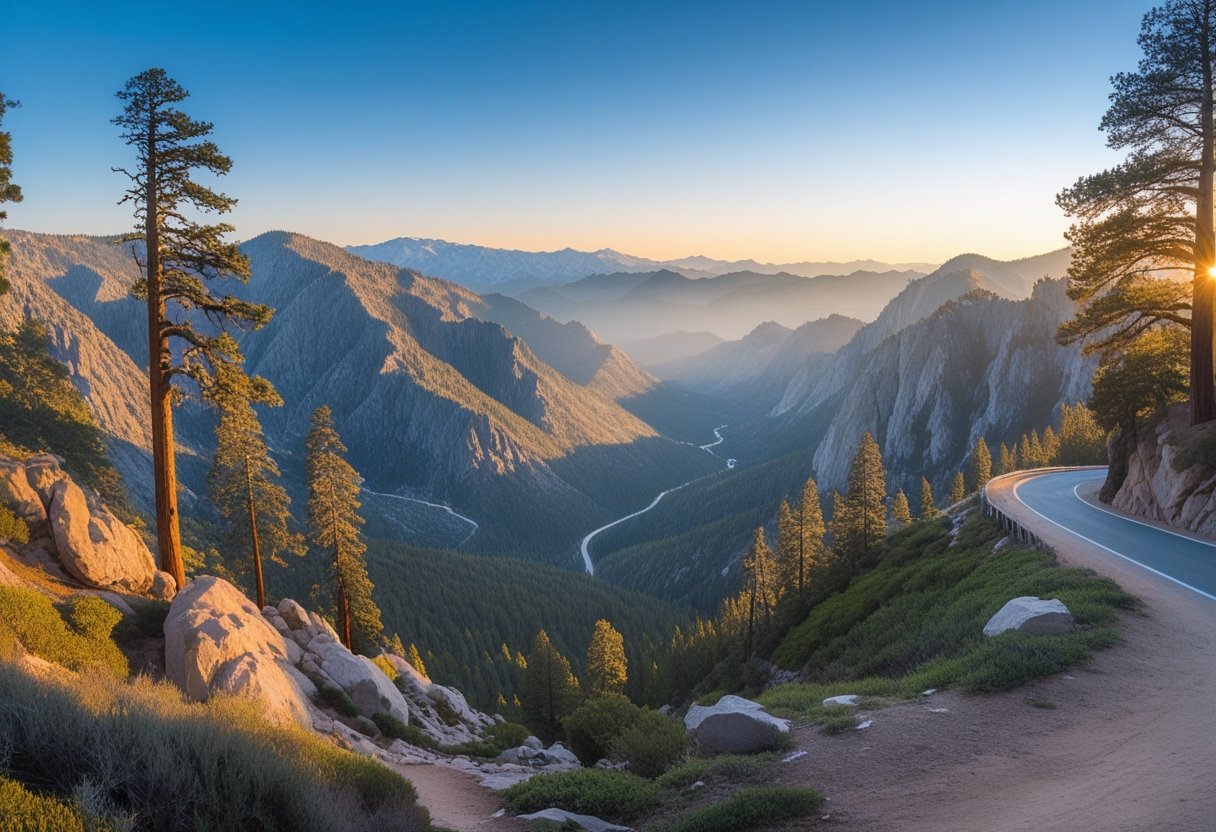
California’s mountain parks deliver towering granite cliffs, ancient sequoia groves, and alpine lakes that rank among the world’s most stunning landscapes. From Yosemite’s iconic formations to Lake Tahoe’s crystal waters and the volcanic terrain of Lassen, these destinations offer year-round outdoor activities.
Yosemite National Park: Icons and Trails
You’ll find Yosemite in the Sierra Nevada mountains, protected since 1890. The park features granite landmarks like El Capitan and Half Dome, plus waterfalls including 2,425-foot Yosemite Falls.
Key viewpoints and stops:
- Tunnel View on Highway 41 gives you El Capitan on the left, Bridalveil Fall on the right, and Half Dome in the distance
- Glacier Point provides panoramic views of the valley floor and high country
- Mariposa Grove contains over 500 giant sequoias, including the Grizzly Giant
Popular hikes include Mist Trail to Vernal Falls, Mirror Lake Loop, and Lower Yosemite Falls. You can bike through the valley or take free shuttle buses during peak season. Park reservations are required on weekends from April through June and daily from July through mid-August. Towns like Mariposa and El Portal offer lodging within 30-40 minutes of park entrances.
Lake Tahoe and Sierra Nevada Gems
Lake Tahoe sits at 6,225 feet elevation on the California-Nevada border. The lake spans 22 miles long and reaches depths of 1,645 feet, making it the second deepest lake in the United States.
You can ski at resorts like Palisades Tahoe in winter or swim at beaches in Tahoe City during summer. The Tahoe Rim Trail offers 165 miles of hiking with lake views. Emerald Bay State Park features Vikingsholm Castle and hiking to Eagle Falls.
Mount Shasta activities:
- Climb the 14,179-foot volcanic peak
- Visit three-tiered McCloud Falls in Shasta-Trinity National Forest
- Fish in alpine lakes and streams
The area stays accessible year-round, though you’ll need chains for winter driving.
Sequoia, Kings Canyon, and Lassen Volcanic
Sequoia and Kings Canyon sit next to each other and share one entrance fee. You’ll see the General Sherman Tree, the world’s largest tree by volume, in the Giant Forest. Kings Canyon’s granite walls reach depths of 8,200 feet.
These parks require 2-3 days to explore properly. Highway 180 leads to Kings Canyon’s scenic viewpoints and trailheads. The parks connect to Yosemite via a 5-6 hour drive.
Lassen Volcanic highlights:
- Bumpass Hell boardwalk trail through active geothermal features
- Manzanita Lake for kayaking and photography
- Snow-covered volcanic peaks and wildflower meadows
Lassen stays partially closed in winter, with main roads typically opening by late June. The park sits in Northern California, about four hours from both San Francisco and Reno.
Deserts, Dunes, and Offbeat Highways
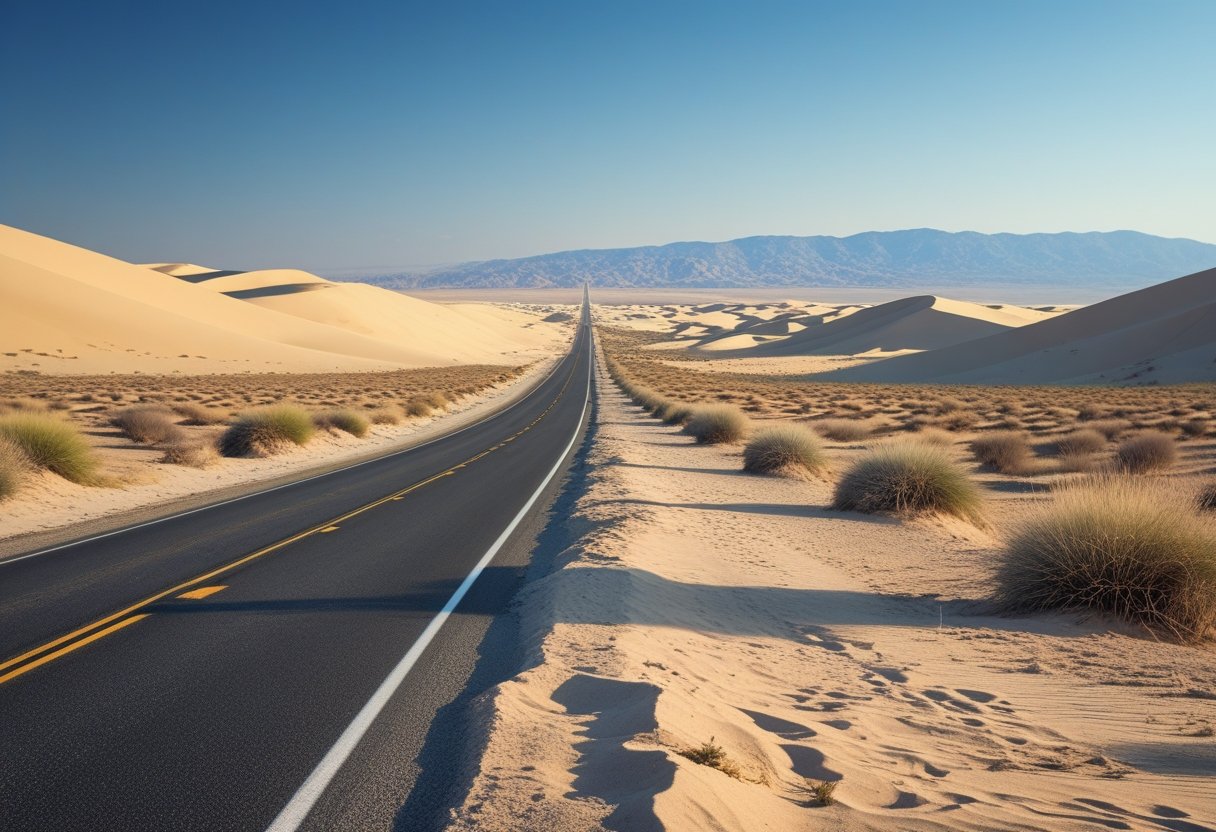
California’s desert regions offer landscapes that range from salt flats below sea level to boulder-strewn valleys filled with twisted Joshua trees. The best time to visit is November through March when daytime temperatures sit in the 60s and 70s instead of the brutal summer heat.
Death Valley National Park and Surrounds
Death Valley National Park sits as the hottest and driest place in North America. You can drive to Badwater Basin at 282 feet below sea level, making it the lowest point in the continent. The park features colorful canyons with pink, rust, and lavender rock formations at Artist’s Palette.
Must-see spots include:
- Zabriskie Point for sunrise views over golden badlands
- Dante’s View for panoramic vistas from 5,000 feet up
- Mesquite Flat Sand Dunes for classic desert scenery
The Alabama Hills sit just outside the park near Lone Pine. These rounded rock formations have appeared in hundreds of Western films. Mobius Arch frames Mount Whitney perfectly and requires only a short hike to reach.
Gas and supplies are available at Furnace Creek inside the park. Fill up your tank before entering since stations are few and far between.
Joshua Tree National Park Adventures
Joshua Tree National Park blends two distinct desert ecosystems where the Mojave and Colorado deserts meet. The park’s namesake Joshua trees create alien-looking forests that seem pulled from a fantasy book.
Barker Dam offers an easy walk where bighorn sheep sometimes drink water. Keys View provides sweeping vistas across the Coachella Valley to Mexico on clear days. The Cholla Cactus Garden glows golden during late afternoon light.
Rock climbers flock here for world-class boulder problems and crack climbs. Hikers can explore Hidden Valley or tackle longer trails into the backcountry. Spring brings wildflower blooms and cacti flowers from March through May.
No gas stations exist inside the park. Stock up in Joshua Tree, Yucca Valley, or Twentynine Palms before entering.
Greater Palm Springs and the Salton Sea
Palm Springs serves as the desert’s mid-century modern oasis. The Palm Springs Aerial Tramway climbs from the desert floor to alpine forests in 10 minutes. Downtown features retro architecture, boutique shops, and dozens of restaurants.
The Salton Sea sits as California’s largest lake, created accidentally in 1905. The shoreline has a post-apocalyptic feel with abandoned buildings and art installations. Salvation Mountain near Niland displays folk art painted across a small hill. East Jesus is an outdoor art installation built from desert salvage.
The Cabazon Dinosaurs stand as roadside icons along Interstate 10. These massive sculptures appeared in films and mark the gateway to the desert region. They make a quick photo stop on your way to or from Palm Springs.
Redwoods, North Coast, and Hidden Natural Wonders
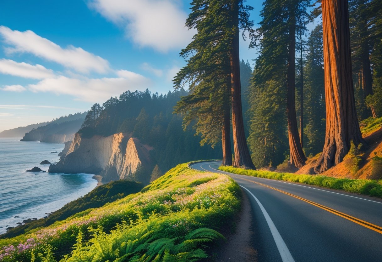
Northern California’s coast stretches through some of the tallest forests on Earth, with redwood groves standing beside rocky cliffs and secluded beaches. The region covers hundreds of miles from the San Francisco Bay Area to the Oregon border, where state and national parks protect ancient trees and wild coastline.
Avenue of the Giants and Humboldt Redwoods
The Avenue of the Giants runs for 31 miles through Humboldt Redwoods State Park, parallel to Highway 101. This scenic byway takes you directly through old-growth redwood groves where trees reach over 300 feet tall.
Founders Grove sits along the Avenue and features a wheelchair-accessible loop trail. You can walk among trees that are over 300 years old in just 30 minutes. The Founders Tree once held the title of world’s tallest tree at 346 feet.
The park contains over 53,000 acres of forest, including the largest remaining stand of virgin redwoods in the world. You’ll find camping, hiking, and swimming spots along the South Fork Eel River. Summer offers the best weather for exploring, though fog often rolls in near the coast even during warm months.
Plan at least 2-3 hours to drive the full avenue without stops. Add extra time for short walks through the groves or longer hikes into the backcountry.
Mendocino and the Rugged Coast
Mendocino sits on a headland 150 miles north of San Francisco. The town features Victorian buildings, art galleries, and dramatic ocean views from coastal bluffs.
Fort Bragg lies 10 miles north and offers access to Glass Beach, where decades of wave action have smoothed discarded glass into colorful pebbles. MacKerricher State Park extends along the coast here with trails for walking and wildlife watching.
Van Damme State Park protects a unique pygmy forest where ancient soil conditions have created a woodland of stunted trees. Mature cypress and pine trees grow only a few feet tall due to nutrient-poor hardpan. The park also includes a fern canyon and ocean access.
The coastal route along Highway 1 connects these towns through winding roads with ocean overlooks. Spring brings wildflowers to the headlands, while winter storms create dramatic wave action against the cliffs.
National and State Park Highlights
Redwood National Park works together with three California state parks to protect 139,000 acres of coast redwoods. The parks form a chain along the northern coast near Crescent City.
Lady Bird Johnson Grove offers a 1.4-mile loop through old-growth forest. The trail stays relatively flat and takes about an hour to complete. You’ll walk among redwoods while learning about forest ecology from interpretive signs.
Jedediah Smith Redwoods State Park contains some of the densest old-growth redwood forest remaining. The Stout Grove trail leads to particularly massive trees in just half a mile. The Smith River runs through the park, providing opportunities for fishing and kayaking.
Prairie Creek Redwoods State Park protects both forest and coastline. Elk often graze in the meadows near the visitor center. Fern Canyon features 50-foot walls covered in five-finger ferns, created by Home Creek cutting through the rock.
You need a parks pass for most areas. Some parks charge separate day-use fees while others accept the America the Beautiful pass.
Classic California Road Trip Experiences
California road trips offer distinctive experiences that go beyond just driving. You’ll find everything from famous landmarks to small coastal towns and memorable places to stay along the way.
Must-See Landmarks and Roadside Attractions
The Golden Gate Bridge in San Francisco stands as one of California’s most photographed structures. You can walk across it or view it from nearby lookout points.
Big Sur’s Bixby Bridge offers dramatic ocean views from Highway 1. The bridge sits 260 feet above a canyon and provides easy photo opportunities from pullouts on either side.
In Southern California, the Hollywood Sign remains a must-see landmark. You can hike to it or view it from Griffith Observatory, which also offers free entry and city views.
Hearst Castle near San Simeon features 165 rooms and sits on a hilltop overlooking the Pacific. Tours run daily and showcase the estate’s art collection and architecture.
The Glass Beach in Fort Bragg displays smooth, colorful glass pieces created from years of ocean tumbling. You can’t take the glass, but it makes for unique photos at MacKerricher State Park.
Beach Towns and Iconic Coastlines
Malibu stretches 21 miles along the coast and offers several beach options. Zuma Beach provides wide, sandy shores and good waves for bodyboarding.
Laguna Beach features art galleries, tide pools, and 30 public beaches. Heisler Park sits on bluffs above the ocean and includes walking paths and benches for sunset viewing.
Crystal Cove State Park contains three miles of beach and a historic district with 1930s-era cottages you can rent overnight. The Beachcomber Cafe serves breakfast and lunch right on the sand.
Huntington Beach earned its “Surf City USA” nickname through its consistent waves and surf culture. The pier extends 1,850 feet into the ocean and hosts free concerts in summer.
Encinitas and Oceanside both offer laid-back beach town vibes in North San Diego County. Encinitas has Swami’s Beach for surfing, while Oceanside features a 1,942-foot wooden pier and the California Surf Museum.
Catalina Island sits 22 miles off the coast and requires a ferry ride from several mainland ports. The island has no chain stores and limited cars, making it feel removed from typical California life.
Unique Hotels and Quirky Stops
The Madonna Inn in San Luis Obispo features 110 themed rooms, each with different decor. The men’s restroom has a waterfall urinal that attracts visitors even when they’re not staying overnight. The pink exterior and over-the-top decorations make it a photo-worthy stop.
Pea Soup Andersen’s in Buellton has served split pea soup since 1924. The restaurant includes a gift shop and bakery alongside its Danish-themed dining room.
The Cabazon Dinosaurs near Palm Springs feature two massive dinosaur sculptures visible from Interstate 10. You can climb inside the larger T-Rex and visit the small museum at its base.
Salvation Mountain near the Salton Sea displays bright colors and religious messages across a small desert hill. Artist Leonard Knight built it over several decades using adobe, straw, and paint.
Historic motor courts and vintage motels dot Highway 1 and Route 66. Many maintain their original neon signs and mid-century architecture while offering updated amenities inside.
Frequently Asked Questions
California offers diverse routes from coastal highways to mountain passes, with ideal trip lengths ranging from quick weekend getaways to extended two-week adventures. Spring and fall provide the best weather conditions for most destinations.
What are the top scenic routes to include in a California road trip itinerary?
Highway 1 along the Pacific Coast stands as California’s most famous scenic drive. This route stretches over 650 miles from Dana Point in Orange County to Mendocino County, passing through Big Sur’s dramatic coastline.
Highway 395 provides access to the Eastern Sierra’s natural beauty. You’ll drive past Lake Tahoe and have easy access to Yosemite National Park.
The Silverado Trail winds through Napa Valley’s wine country. This route offers vineyard views and tasting rooms without the heavy traffic of Highway 29.
Highway 101 in Northern California takes you through redwood forests and coastal towns. The Rim of the World Scenic Byway in the Inland Empire gives you mountain views close to Southern California’s urban areas.
How long should an ideal road trip through California last to cover the main attractions?
A comprehensive California road trip requires at least 10 to 14 days to cover major attractions. This timeframe allows you to visit multiple regions without rushing through each destination.
Weekend trips work well for focused itineraries within one region. You can explore a single area like wine country, the Central Coast, or desert attractions in two to three days.
Week-long trips let you combine two or three major regions. You might pair San Francisco with Yosemite and Lake Tahoe, or explore the Southern California coast from Los Angeles to San Diego.
Your ideal length depends on your specific interests and how much time you want at each stop. Budget extra days if you plan to hike in national parks or spend time in cities.
Which landmarks are a must-visit when embarking on a California road journey?
Yosemite National Park features granite cliffs, waterfalls, and giant sequoia groves. You’ll need to check if reservations or permits are required before your visit.
Big Sur offers dramatic coastal scenery along Highway 1. The Golden Gate Bridge in San Francisco provides iconic photo opportunities and connects the city to Marin County’s natural areas.
Lake Tahoe straddles the California-Nevada border with clear alpine waters. Disneyland Resort and other Southern California theme parks attract families year-round.
Redwood National and State Parks protect the world’s tallest trees. The Monterey Bay Aquarium showcases marine life from California’s central coast.
Death Valley National Park presents unique desert landscapes. Palm Springs combines mid-century modern architecture with desert recreation and hot springs.
What is the best time of year to go on a road trip in California?
Spring from March to May delivers sunny weather and smaller crowds at most destinations. Wildflowers bloom in valleys and deserts during late February and March.
Fall from September to November offers similar benefits with warm days and fewer tourists. You’ll find the best weather for beach visits during these shoulder seasons.
Winter from late November to April suits ski resort visits and snow activities. January and February have shorter lines at theme parks.
Summer brings peak tourist season with higher prices and crowded attractions. Coastal areas stay cooler than inland regions during summer months.
Can you suggest a California road trip map that encompasses all the major sites?
A complete California loop covers approximately 1,500 to 2,000 miles depending on your specific stops. Start in San Francisco, head south on Highway 1 through Big Sur to Los Angeles and San Diego.
From San Diego, travel east to Palm Springs and Joshua Tree National Park. Continue north through Death Valley or along Highway 395 to reach the Eastern Sierra and Yosemite.
Loop back to San Francisco through Lake Tahoe and Sacramento. This route hits coastal, desert, and mountain regions within two weeks.
You can modify this loop by adding Highway 101 through wine country or extending north to the redwood forests. Download offline maps or carry paper maps for areas with limited cell service.
Are there recommended one-day road trip ideas for quick escapades in California?
The San Francisco to Muir Woods and Sausalito loop takes about six to eight hours. You’ll see giant redwoods and waterfront views without staying overnight.
Los Angeles to Santa Barbara covers about 95 miles each way along the coast. You can visit beaches, explore downtown Santa Barbara, and return the same day.
San Diego to Julian offers a mountain town experience with apple pie and historic sites. This 60-mile drive takes you from sea level to 4,000 feet elevation.
Sacramento to Apple Hill in El Dorado County works well during fall harvest season. Palm Springs to Idyllwild provides a quick escape from desert heat to pine forests.
The Napa Valley loop from San Francisco allows wine tasting and gourmet dining within a day trip. Monterey and Carmel-by-the-Sea sit close enough to most Bay Area locations for same-day visits.
Leave a Reply